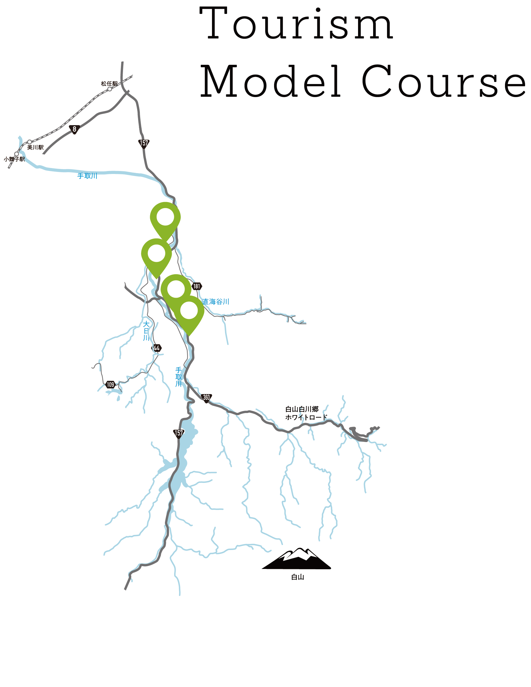
TOURISM MODEL COURSE
Follow the Journey of Water! A Photogenic Journey with a Relaxing End
The Tedori River which flows from Mt. Hakusan, has formed the land that makes up Hakusan City. The river has eroded deeply into the volcanic deposits which were formed 15 to 20 million years ago when the Sea of Japan began to form. From the deep past to the Jomon Period, the Sengoku Period of Warring States, to the Meiji Era, the Tedori River has shaped the lives of the people who live here. On this course you can see and experience up-close how water has shaped the land, and how it is used by the people.
Required Time: Approx. 4 Hours
Mode of Transport: Car
Mode of Transport: Car
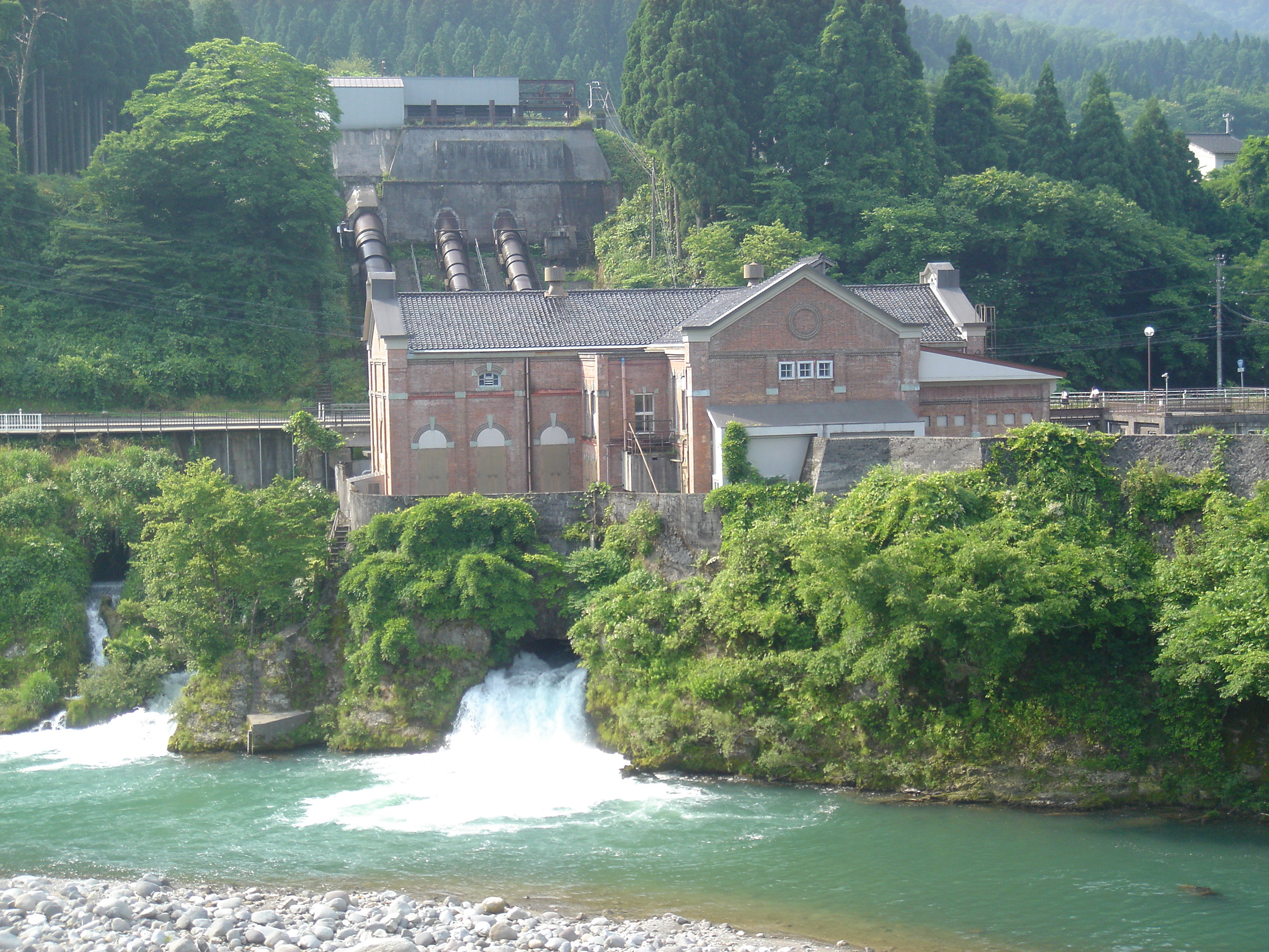
Fukuoka Dai-ichi Power Station
1
The Fukuoka Dai-ichi Power Station, built in 1911, was the first hydroelectric power plant built along the Tedori River. Made with modern western-style architecture, its retro-modern exterior stands out against the natural surroundings. It is registered as a National Tangible Cultural Property.
Address
169-1 Kawachimachi Fukuoka, Hakusan, Ishikawa
169-1 Kawachimachi Fukuoka, Hakusan, Ishikawa
2 Mins by Car
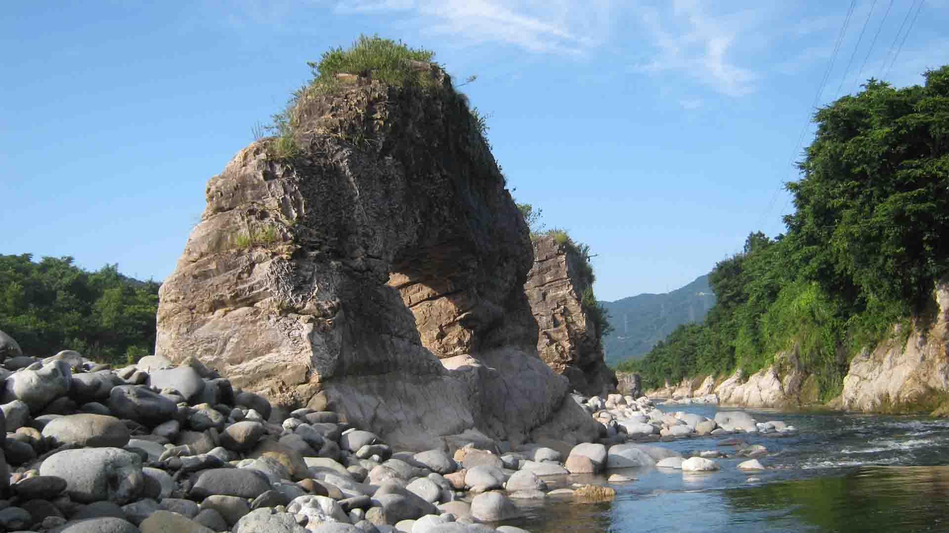
Meoto-iwa and Megane-iwa Rocks (View Spot)
2
The Meoto-iwa and Megane-iwa Rocks are roughly 10m high rocks that managed to evade the erosive power of the Tedori River, made from an intrusion of hard rock. One of the two rocks has a hole on the lower side, so it is called the Megane-iwa (glasses rock). It is nature's unique work of art.
Address
Ishikawa, Hakusan, Kawachimachi Gozu
Ishikawa, Hakusan, Kawachimachi Gozu
10 Mins by Car
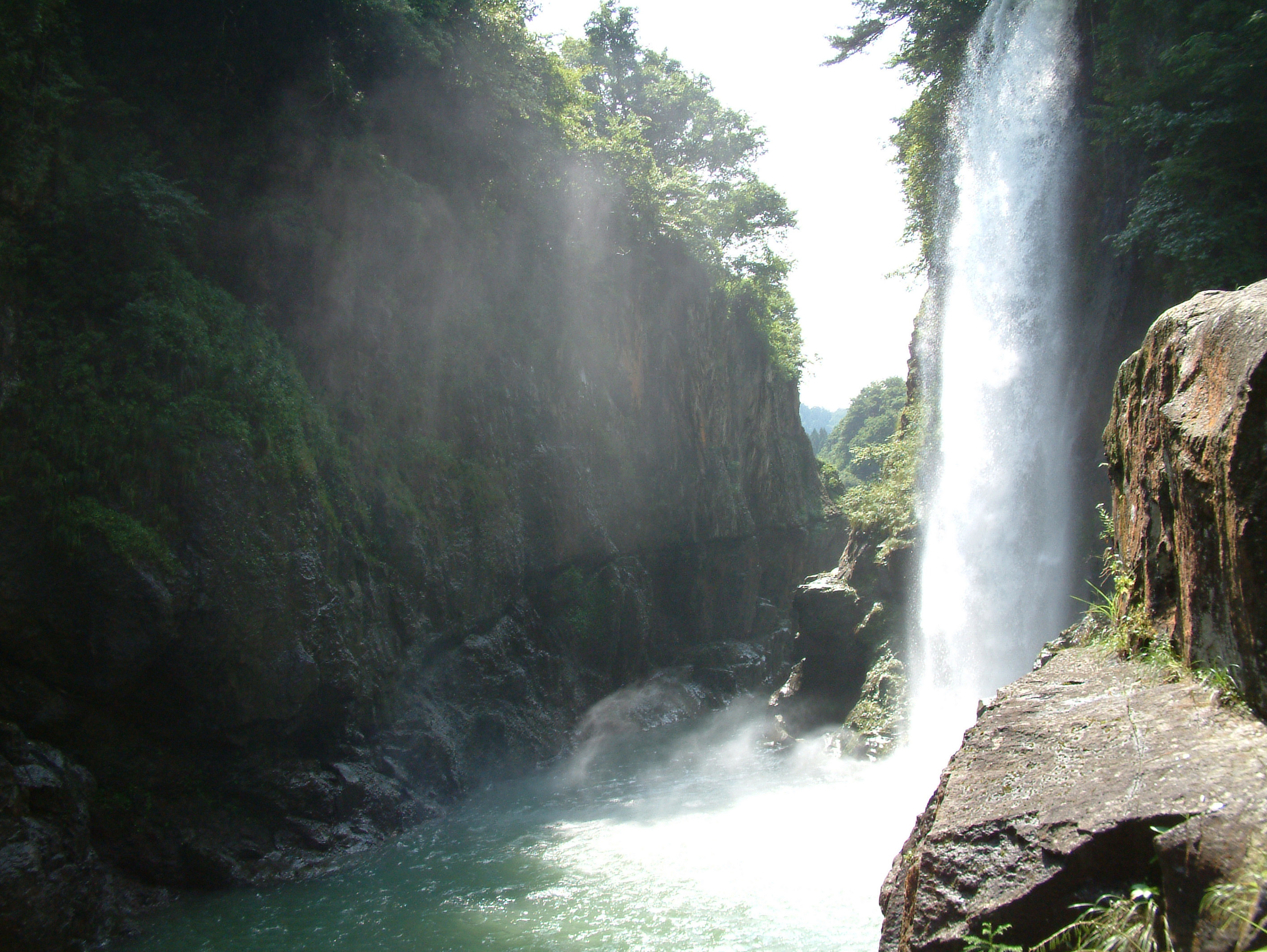
Watagataki Waterfall
3
Located where you least expect it, the Watagataki Waterfall is a majestic fall of about 32m, located deep in the Tedori Gorge. It is named after the word wata “cotton” as its powerful spray looks like scattered tufts of cotton. A lookout platform is located downstream with a clear view of the waterfall. But to feel the spray of water first-hand, climb down the staircase that goes into the gorge.
Address
Shimoyoshitanimachi, Hakusan, Ishikawa
Shimoyoshitanimachi, Hakusan, Ishikawa
5 Mins by Car
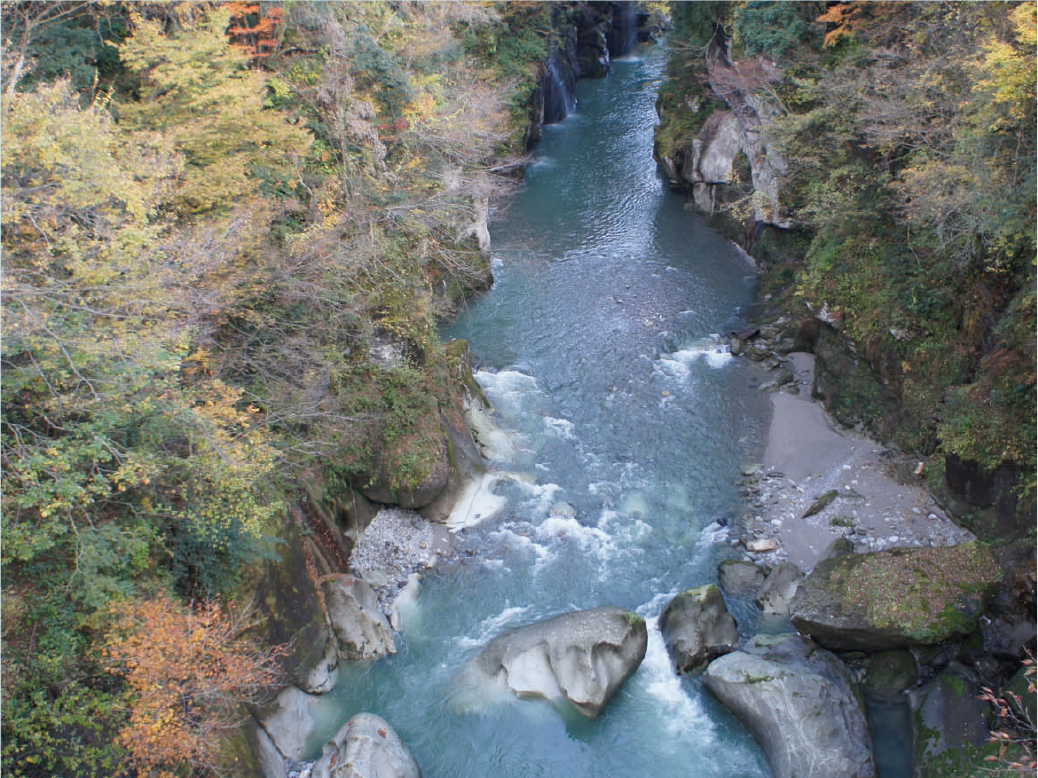
Tedori Gorge (Furo Bridge View Spot)
4
The Tedori Gorge, with 20 to 30m high cliffs, runs approximately 8km through the Tedori River. The foliage on top of the gorge almost seems to spill out over the cliffs, creating a great view, and even better photo. The Tedori River carves deep into the layers of tuff and rhyolite formed during the highly volcanic period when the Sea of Japan was formed. There are also plenty of potholes carved deeply into the rock.
Address
Yoshino, Hakusan, Ishikawa
Yoshino, Hakusan, Ishikawa
15 Mins by Car
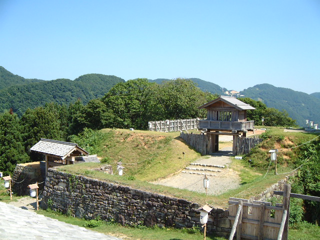
Torigoe Castle Ruins
5
In 1580, during the Sengoku Period of Warring States, the Kaga Rebel Group made their last stand here against the forces of Oda Nobunaga. The Torigoe Castle ruin is located on a mountain between the Tedori River and its tributary the Dainichi River, with another older castle ruin, the Futoge Castle ruin, located on the opposite side of the Dainichi River. The location is highly strategic, allowing you to clearly see up and down the valleys of both rivers. Nowadays this creates a great viewpoint, and allows a clear sight of the terrain and its connection with water.
Address
Misakamachi, Hakusan, Ishikawa
Misakamachi, Hakusan, Ishikawa
10 Mins by Car

Bird Humming Torigoe Hot Spring
6
Bird Humming Torigoe Hot Spring is a facility located in the mid-stream area of the Tedori River, in a quiet area surrounded by the natural beauty of the sacred Mt. Hakusan. Relax and de-stress while feeling the beauty of nature.
Address
Kaminomachi, Hakusan, Ishikawa
Kaminomachi, Hakusan, Ishikawa