AREAS AND SIGHTS

Tedori Gorge
Tedori Kyoukoku
![]()
![]()
![]()
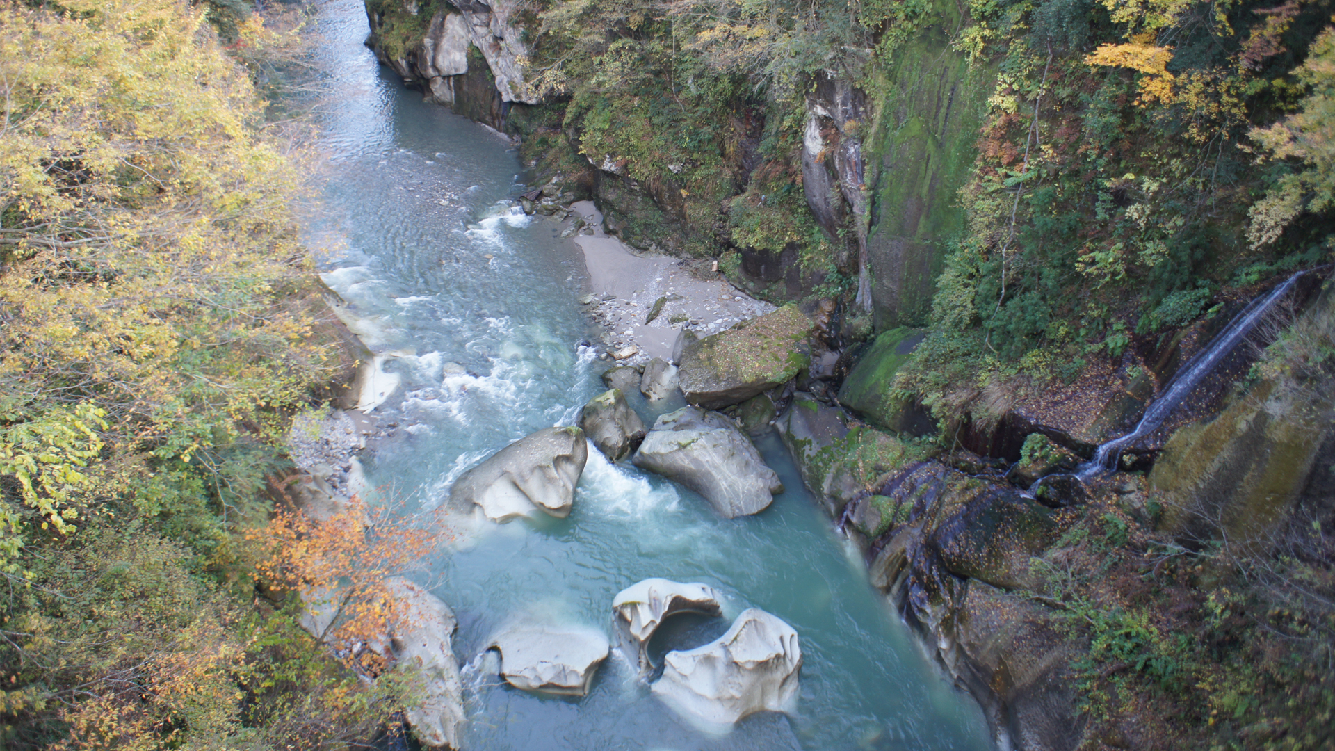
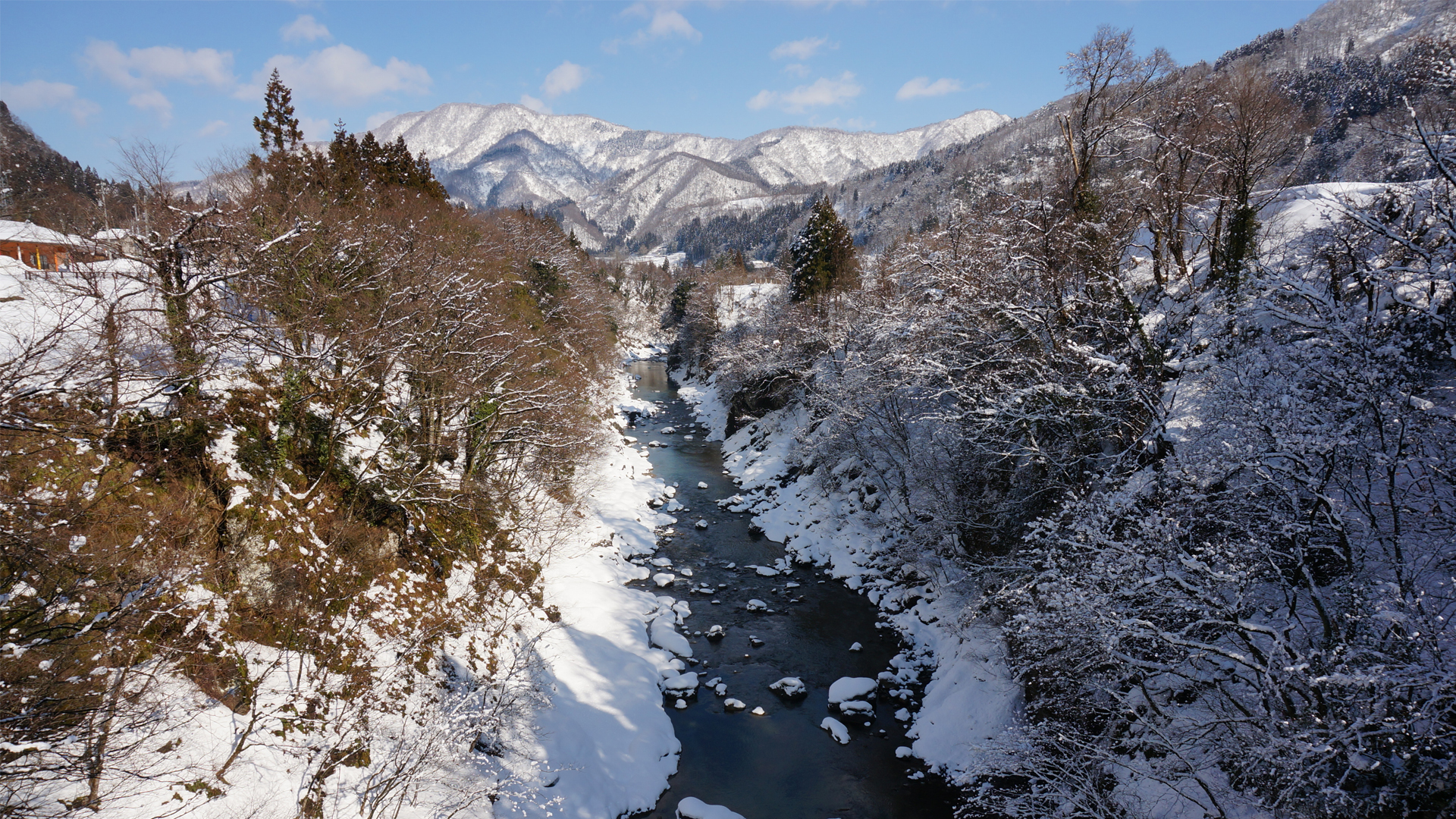
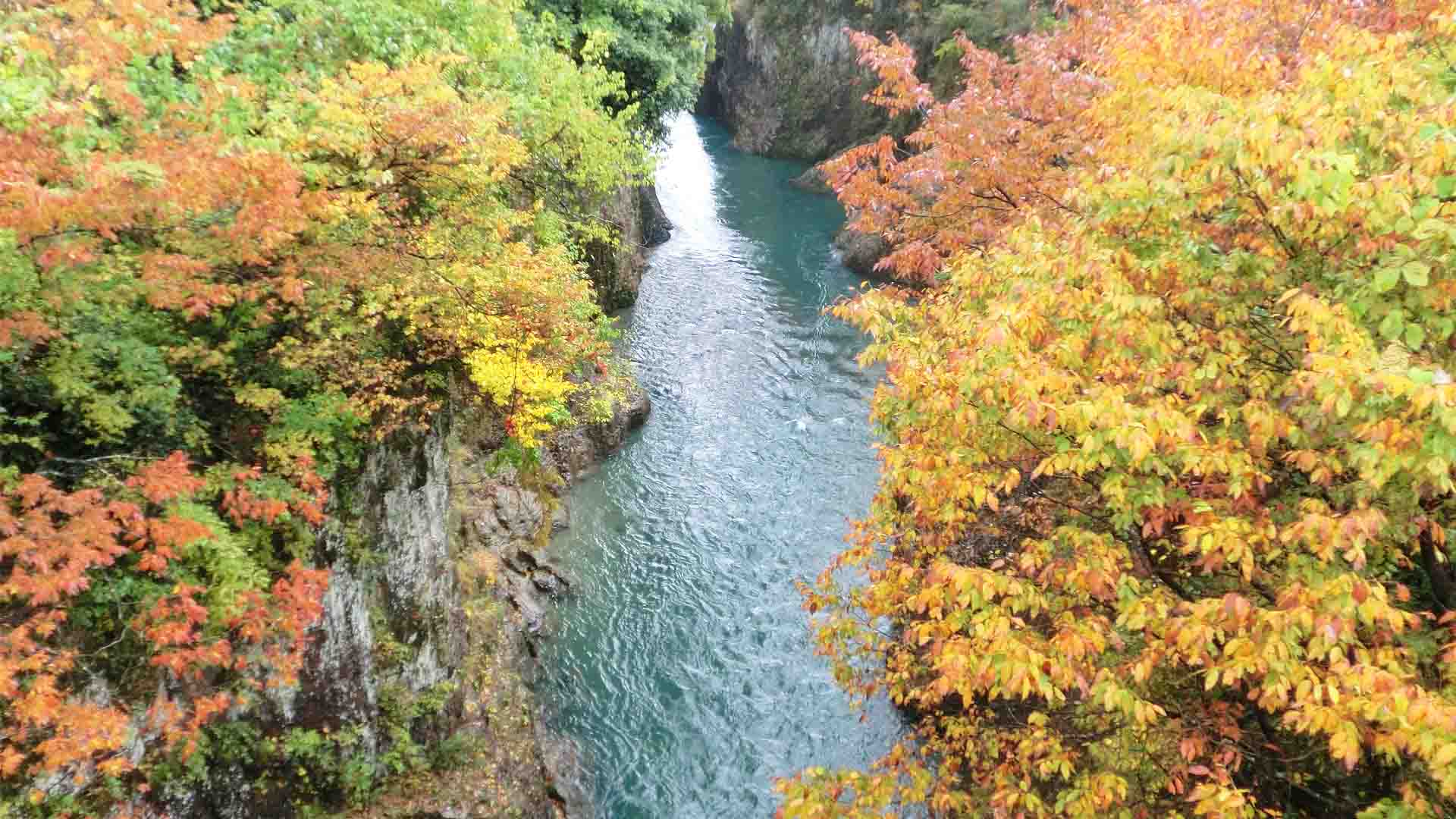
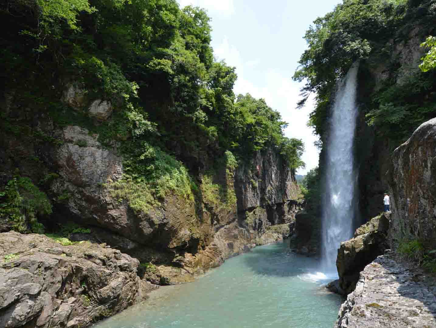
The Tedori Gorge continues for 8 kilometers with 20 to 30 meter high cliffs on each side, from the Komon Bridge in Kamashimizu-machi to the Taizan Bridge in Kawarayama-machi. It was formed by the Tedori River deeply eroding volcanic tuffs and rhyolite as the result of volcanic activities in the Miocene (23 to 5 million years ago) of the Neogene Period. It’s an awe-inspiring location that shows the power of water, and makes for a fantastic photo spot.
The Furo Bridge provides the best lookout spot over the gorge. Looking down from the bridge you can see big holes (potholes) which were formed by stones spinning in the swirling current. Such holes tend to be formed in torrential rivers. Furthermore, in the narrow gorge, various sizes of strangely shaped rocks show the differences of the flow and the effect of erosion. From the Komon Bridge you can see the deep expanse of the gorge with Mt. Hakusan in the distance.
The Furo Bridge provides the best lookout spot over the gorge. Looking down from the bridge you can see big holes (potholes) which were formed by stones spinning in the swirling current. Such holes tend to be formed in torrential rivers. Furthermore, in the narrow gorge, various sizes of strangely shaped rocks show the differences of the flow and the effect of erosion. From the Komon Bridge you can see the deep expanse of the gorge with Mt. Hakusan in the distance.
INFORMATION
Access• Car:
A small carpark is provided for visitors of the canyon at the Furo and Komon Bridges.
Address
Taizan Bridge: <MAP>
Furo Bridge: <MAP>
Komon Bridge: <MAP>
Free Map for Travelling Around Geoparks
Pocket Geo is a free map service that can be accessed online. It includes information about nearby sites and tourist destinations in the geopark. If you click on the sites, you can see pictures and information about them.
Click here to visit Pocket Geo
NEARBY SPOTS