AREAS AND SIGHTS

Watagataki Waterfall
Watagataki
![]()
![]()
![]()
![]()
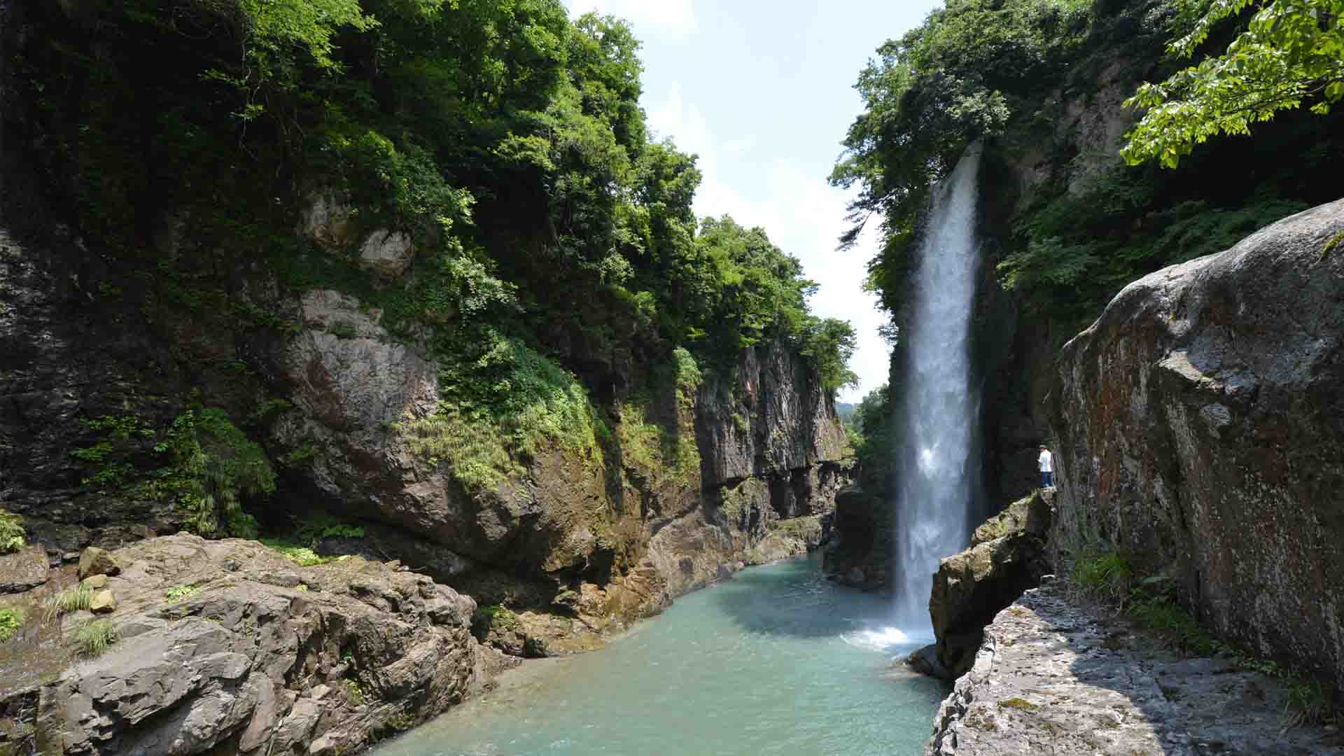
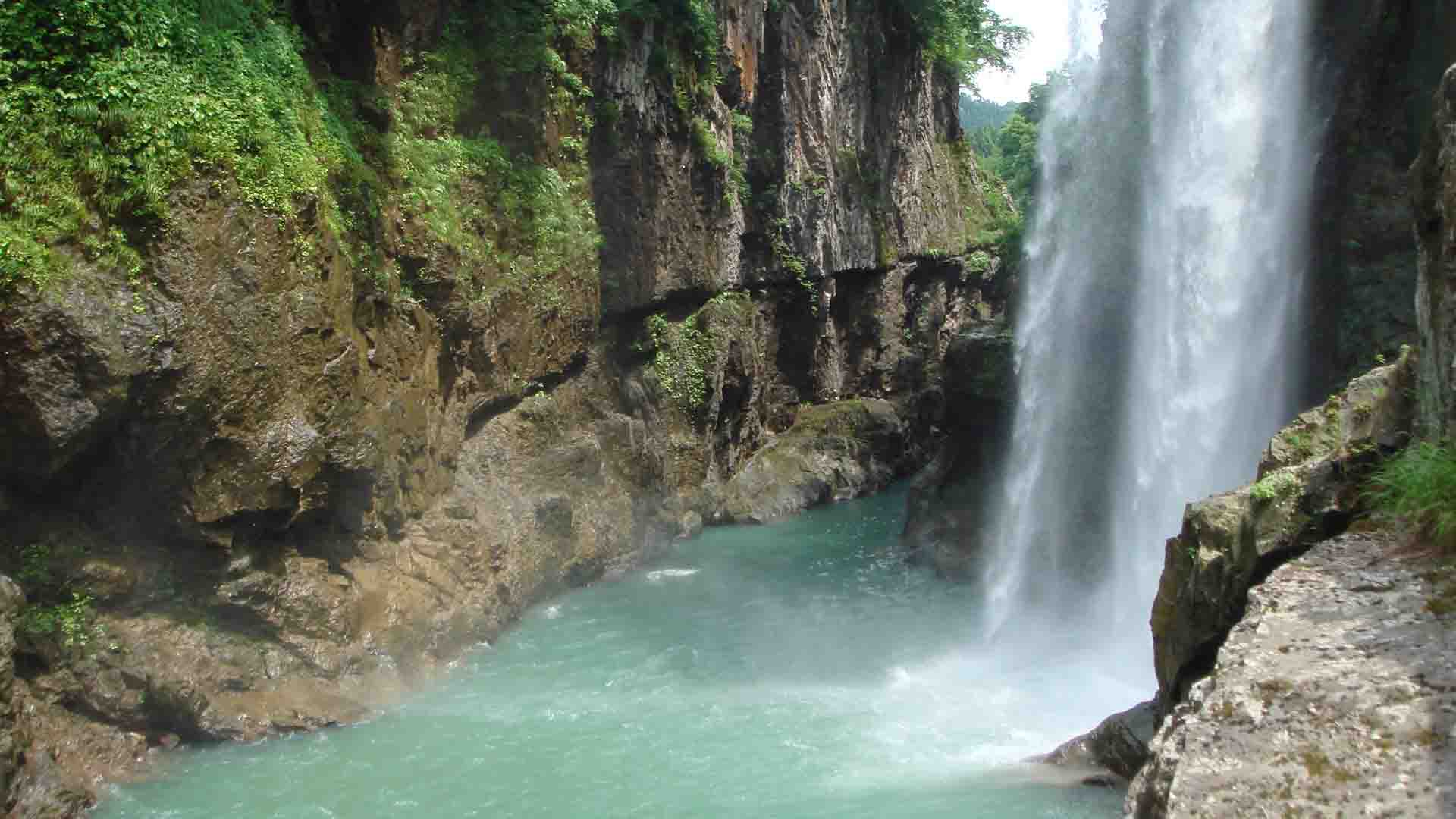
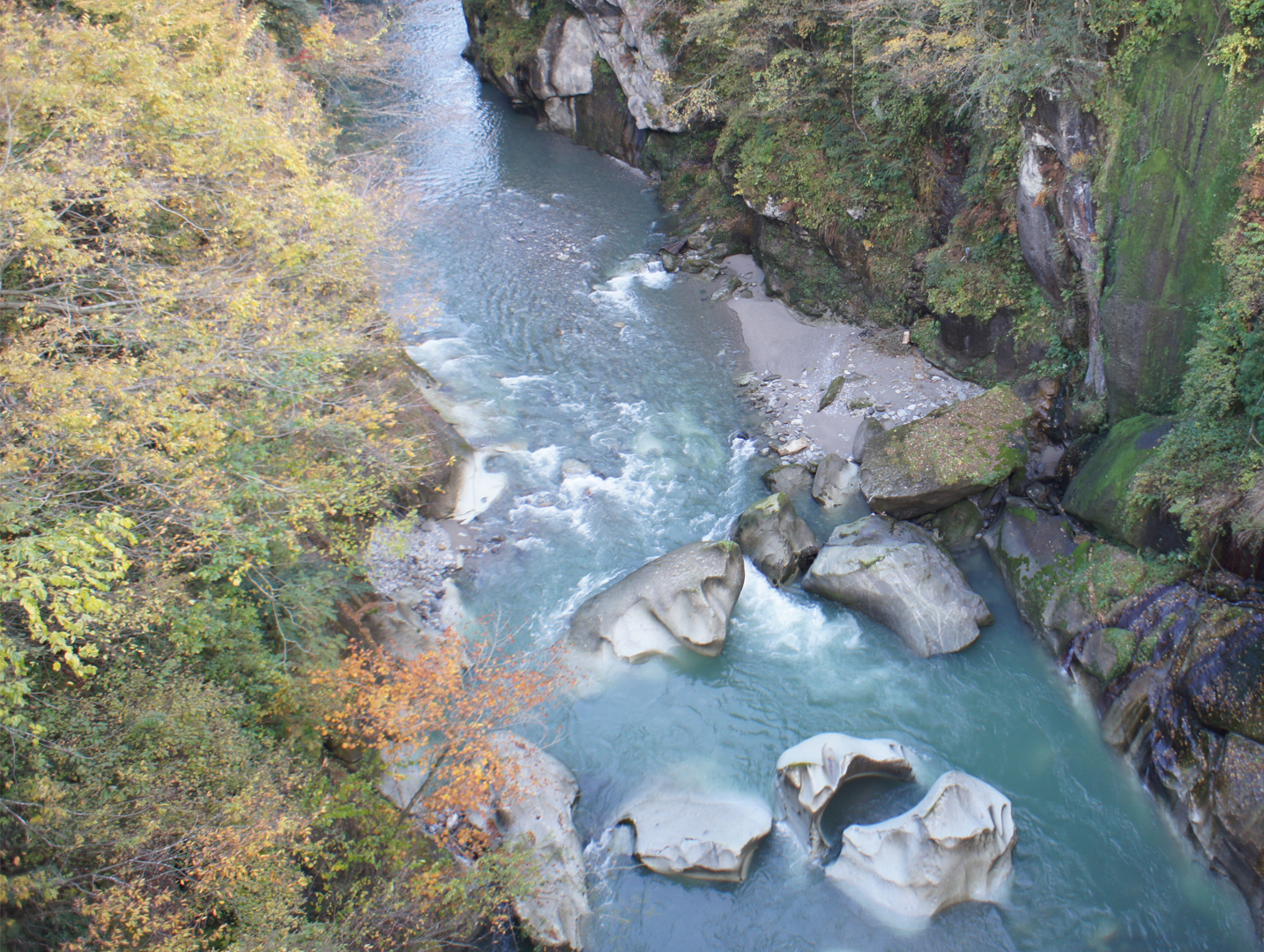
Watagataki Waterfall is named after the word for cotton, ‘wata’, because the foaming waterfall looks like fluttering cotton. The water falls a dramatic 32 meters, surrounded on all sides by sheer cliffs. A lookout is available east of the waterfall, but the best view spot is in the gorge, which can be accessed by a staircase. A restroom is available beside the carpark.
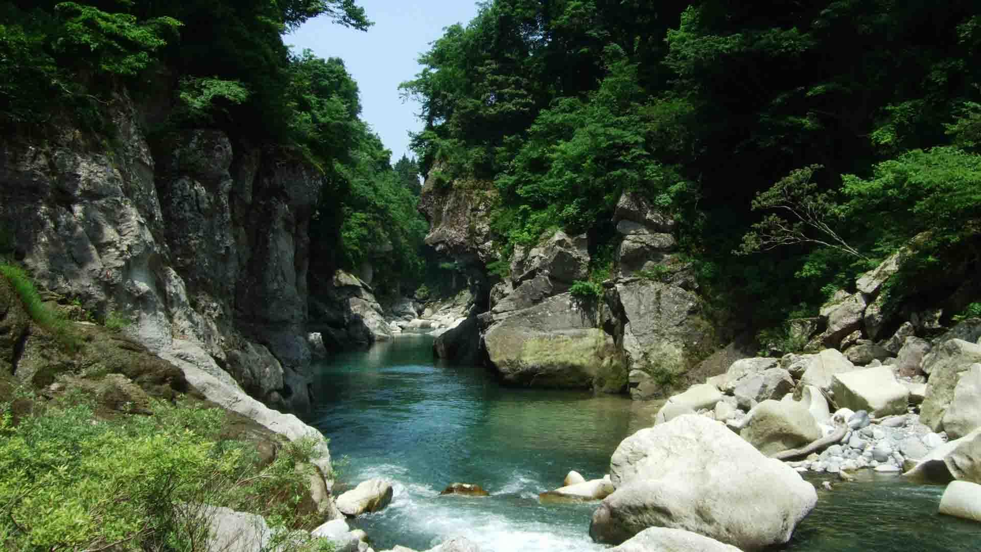
The surrounding gorge was formed by the strong erosive power of the Tedori River, where the bright white and grey rocks of the gorge make for beautiful scenery. The waterfall is fed by a small river that runs through the terraces above the gorge.
The surrounding gorge was formed by the strong erosive power of the Tedori River, where the bright white and grey rocks of the gorge make for beautiful scenery. The waterfall is fed by a small river that runs through the terraces above the gorge.
INFORMATION
Access• Car:
A parking lot is available for visitors.
• Bicycle:
Watagataki Waterfall is located along the Tedori Canyon Road cycling path, approximately 15km (Approx. 70 min ride) from Tsurugi, where bicycles can be rented.
See our access page for how to access Tsurugi and the Tedori Canyon Road, and where to rent bicycles from: Access
Address
Yoshino, Hakusan, Ishikawa<MAP>
Free Map for Travelling Around Geoparks
Pocket Geo is a free map service that can be accessed online. It includes information about nearby sites and tourist destinations in the geopark. If you click on the sites, you can see pictures and information about them.
Click here to visit Pocket Geo
NEARBY SPOTS