AREAS AND SIGHTS

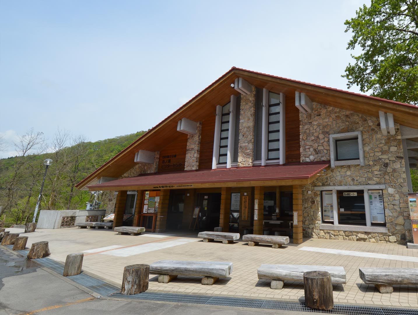
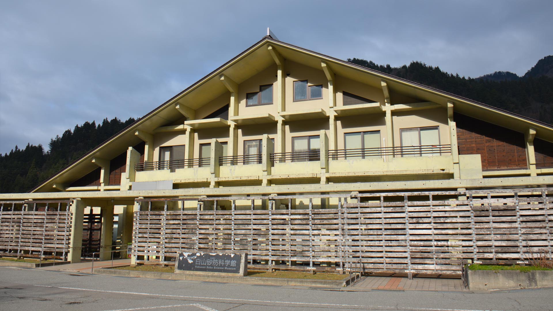
Hakusan Sabou Science Museum
Hakusan Sabou Kagakukan
![]()
![]()
![]()
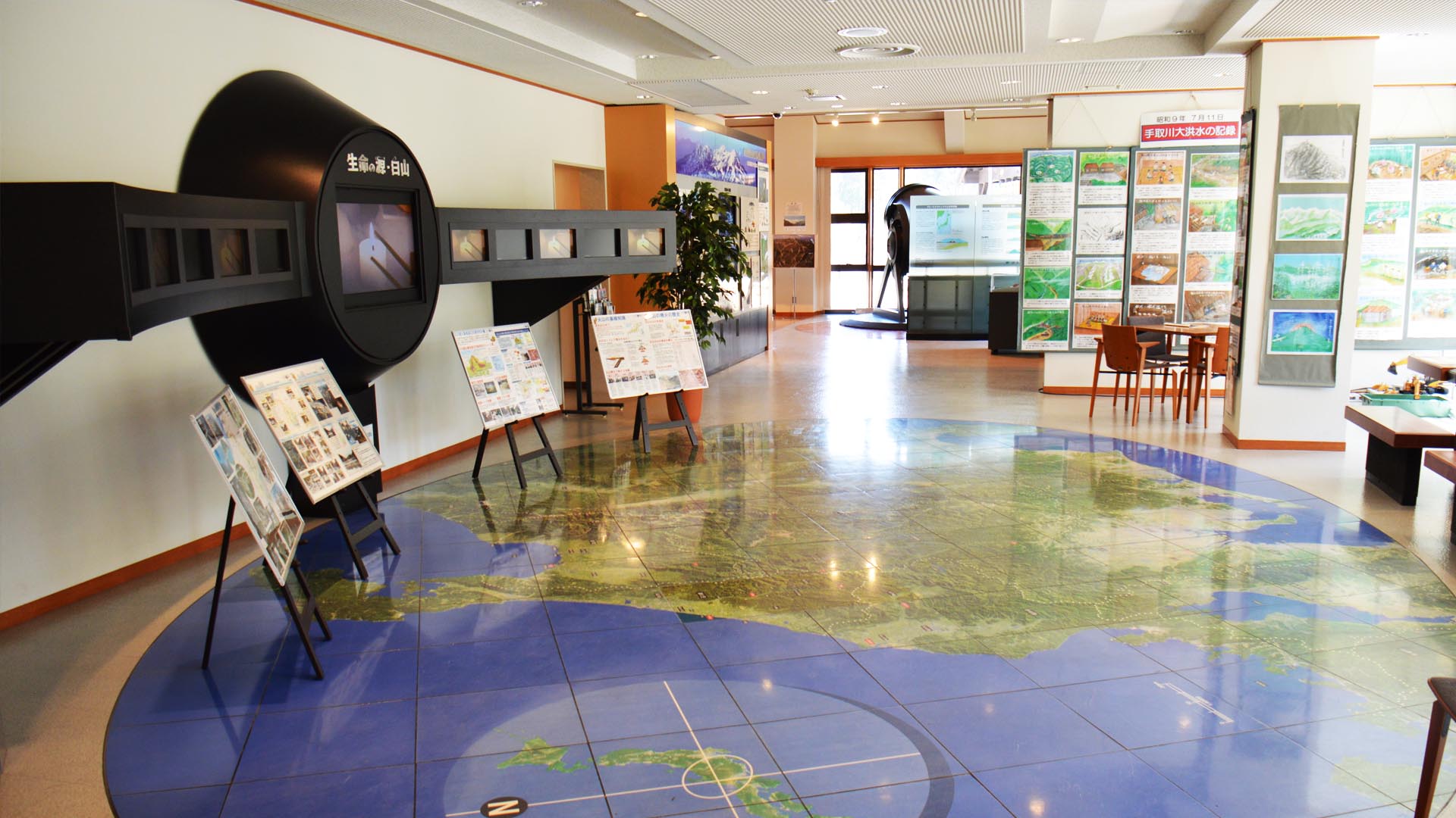
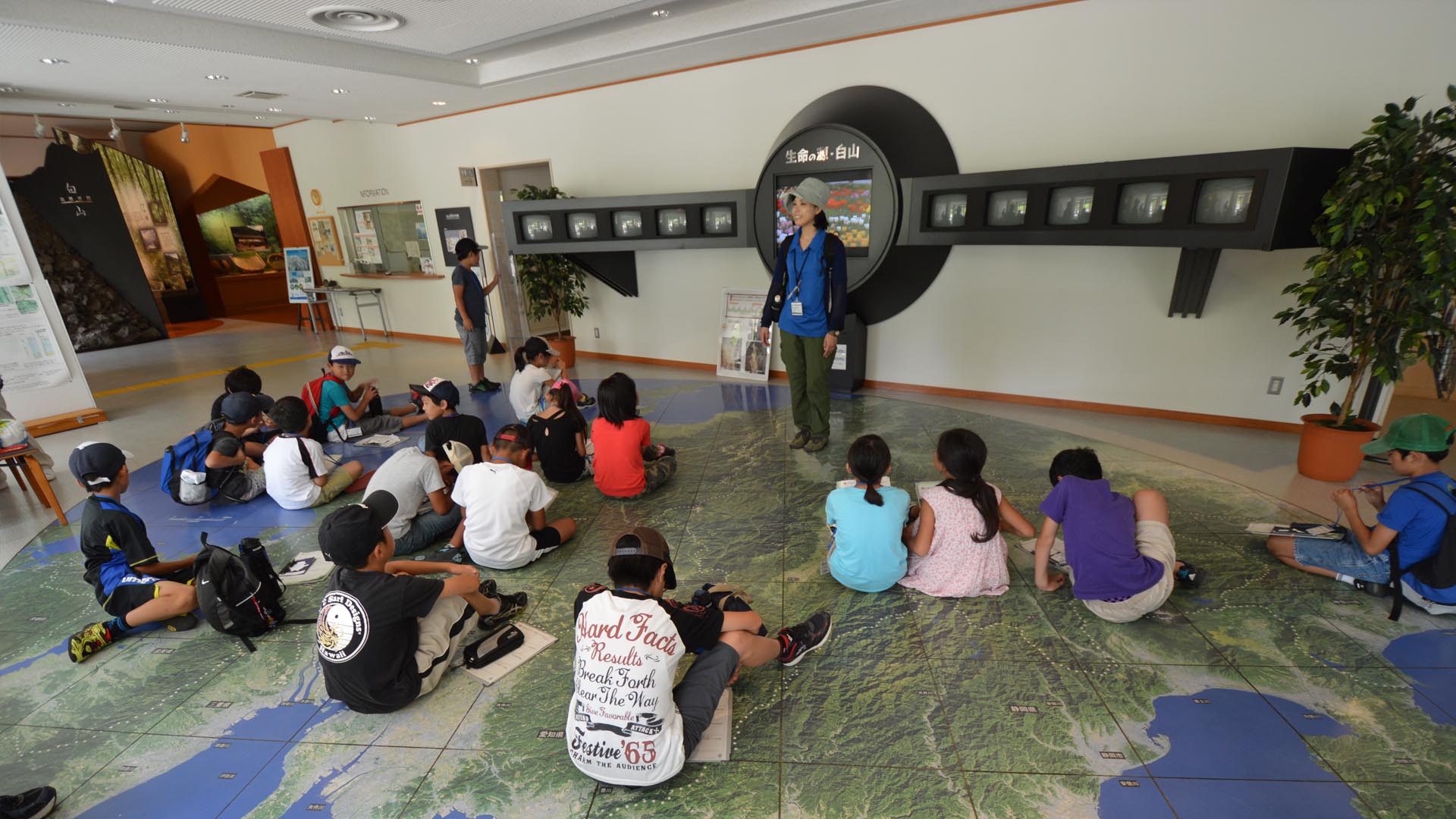
Learn all about the geology of the Mt. Hakusan area at the Sabou Science Museum. First of all, learn about the iconic rocks and formations of the area, such as the famous Hyakumangan no Iwa Rock. As you enter the museum, you can see an aerial photo on the floor, which makes it easy to understand the layout of the area. Unlike the east coast of Japan, where large plains exist between the mountains and the ocean, you can see that Mt. Hakusan and the mountains on the Japan Sea coast are quite close to the ocean. Thus the Tedori River, which flows from the 2702m high Mt. Hakusan, has a very rapid torrent in comparison to other Japanese rivers.
In the museum you can see a lot of interesting features in the aerial photos. Around the summit of Mt. Hakusan, which is still quite a recent volcano, you can see that the terrain is quite gentle because very little erosion has occurred. Whereas further from the summit, high amounts of erosion can be seen, caused by weathering and rock collapse. In order to be able to sustainably live in such a constantly changing environment, erosion and sedimentary control projects called sabo are being carried out.
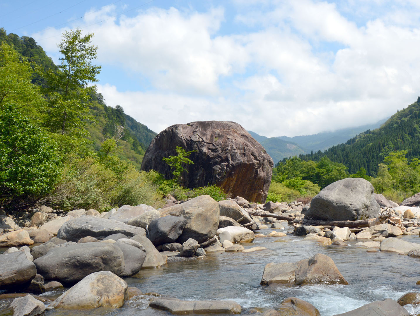
Other exhibits include information on the unique plants that grow in this ever-changing environment. A video explaining the formation of the Hyakumangan no Iwa Rock can also be watched. You can see where the rock came from, and how it ended up at the base of the mountain, in the Tedori River. After that why don’t you go visit the real Hyakumangan no Iwa Rock?
In the museum you can see a lot of interesting features in the aerial photos. Around the summit of Mt. Hakusan, which is still quite a recent volcano, you can see that the terrain is quite gentle because very little erosion has occurred. Whereas further from the summit, high amounts of erosion can be seen, caused by weathering and rock collapse. In order to be able to sustainably live in such a constantly changing environment, erosion and sedimentary control projects called sabo are being carried out.
Other exhibits include information on the unique plants that grow in this ever-changing environment. A video explaining the formation of the Hyakumangan no Iwa Rock can also be watched. You can see where the rock came from, and how it ended up at the base of the mountain, in the Tedori River. After that why don’t you go visit the real Hyakumangan no Iwa Rock?
INFORMATION
Opening Hours:• 9am to 5pm
• Closed Thursdays and New Years
Entry Fee
• Free
Access
• Car:
Parking is available for visitors.
Address
Ishikawa, Hakusan, Shiramine, Tsu<MAP>
Free Map for Travelling Around Geoparks
Pocket Geo is a free map service that can be accessed online. It includes information about nearby sites and tourist destinations in the geopark. If you click on the sites, you can see pictures and information about them.
Click here to visit Pocket Geo