AREAS AND SIGHTS

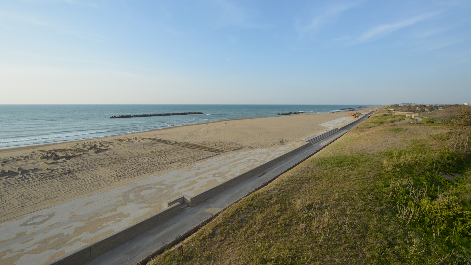
Matto Seaside Park
Mattou Kaihan Kouen
![]()
![]()
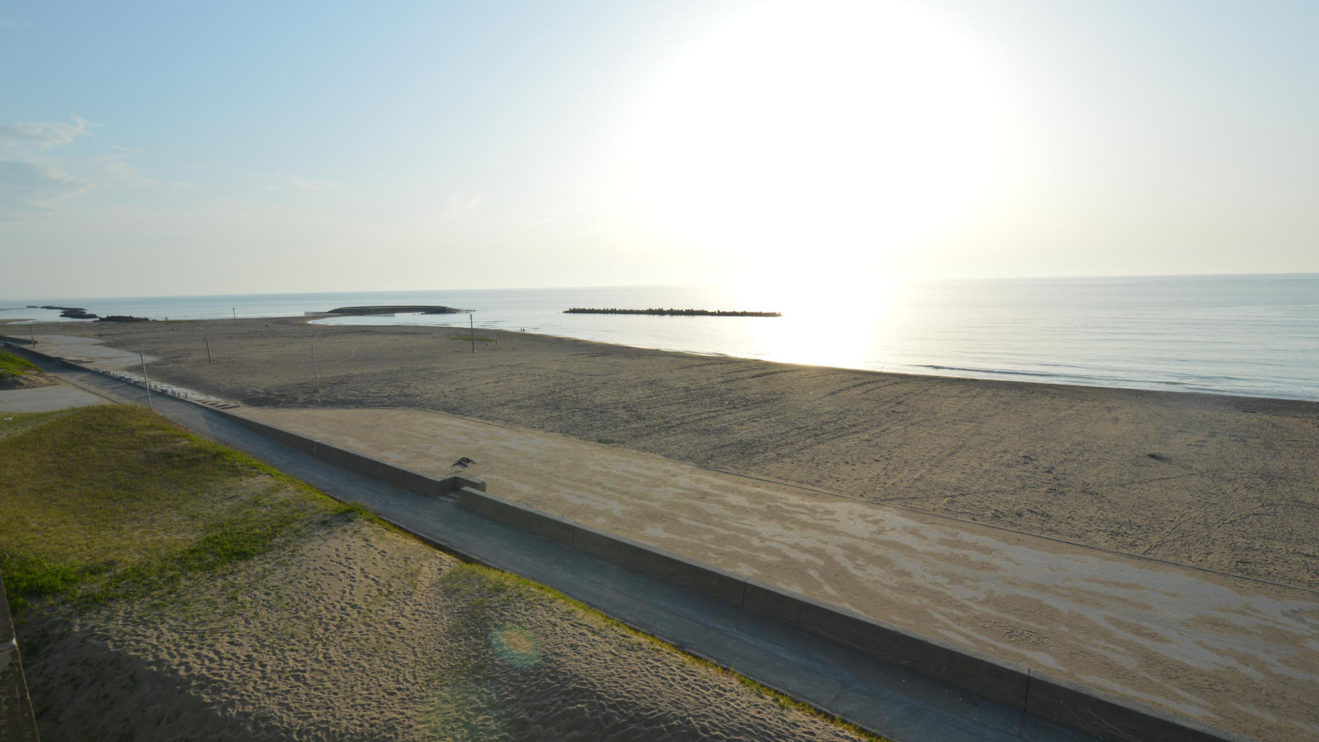
The Matto Seaside Park is one of the beaches that spreads out from the mouth of the Tedori River north to the Noto Peninsula. They were formed by sand from Mt. Hakusan, which travelled to the river mouth, and was then deposited by the Japan Current and strong monsoons. The grains get finer toward the north as heavier grains get deposited first near the mouth of the river. Sand dunes are formed in some parts, including the Yasuhara Sand Dune in Onomachi, Kanazawa City and Tokumitsumachi in Hakusan City. The Yasuhara Sand Dune was formed as black-colored mud deposited on conglomerates of the alluvial fan near the seashore in the early Kofun Era (300 to 538 A.D.).
Matto Seaside Park is a place of relaxation for residents, who utilize the seashore and sand dunes, and enjoy the natural hot spring, pool, barbeque area and golf course. Beach rose (rosa rugosa) and beach silvertop plants (glehnia littoralis) grow naturally along the seashore. In addition, the Submerged Forest which grew eight thousand years ago is still present at the bottom of the sea, two to three kilometers offshore at 20 to 30 meters in depth. At that time it was two to three degrees colder and the seashore was three to four kilometers further toward the sea than the present seashore. It is inferred that the Submerged Forest was located in a lower part of the Tedori River Alluvial Fan, and there was a small sand dune between the forest and the shoreline. It’s also inferred that there were small ponds, streams, and marshes of subsoil water between them. Some of the trees are displayed in the Hakusan City Museum
Matto Seaside Park is a place of relaxation for residents, who utilize the seashore and sand dunes, and enjoy the natural hot spring, pool, barbeque area and golf course. Beach rose (rosa rugosa) and beach silvertop plants (glehnia littoralis) grow naturally along the seashore. In addition, the Submerged Forest which grew eight thousand years ago is still present at the bottom of the sea, two to three kilometers offshore at 20 to 30 meters in depth. At that time it was two to three degrees colder and the seashore was three to four kilometers further toward the sea than the present seashore. It is inferred that the Submerged Forest was located in a lower part of the Tedori River Alluvial Fan, and there was a small sand dune between the forest and the shoreline. It’s also inferred that there were small ponds, streams, and marshes of subsoil water between them. Some of the trees are displayed in the Hakusan City Museum
INFORMATION
Access• Car:
Free parking is available on site.
Address
Sogomachi, Hakusan, Ishikawa<MAP>
Free Map for Travelling Around Geoparks
Pocket Geo is a free map service that can be accessed online. It includes information about nearby sites and tourist destinations in the geopark. If you click on the sites, you can see pictures and information about them.
Click here to visit Pocket Geo