AREAS AND SIGHTS

Shiramine Important Preservation District for Groups of Historic Buildings
Shiramine Jyuuyou Dentouteki Kenzoubutsugun Hozonchiku
![]()
![]()

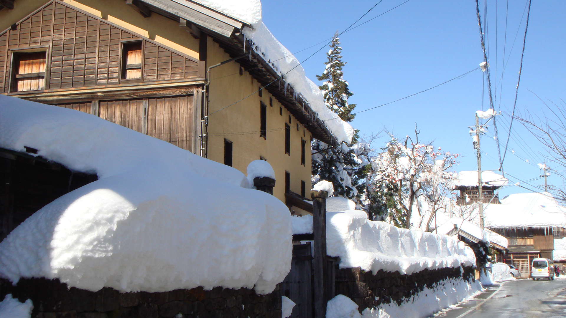
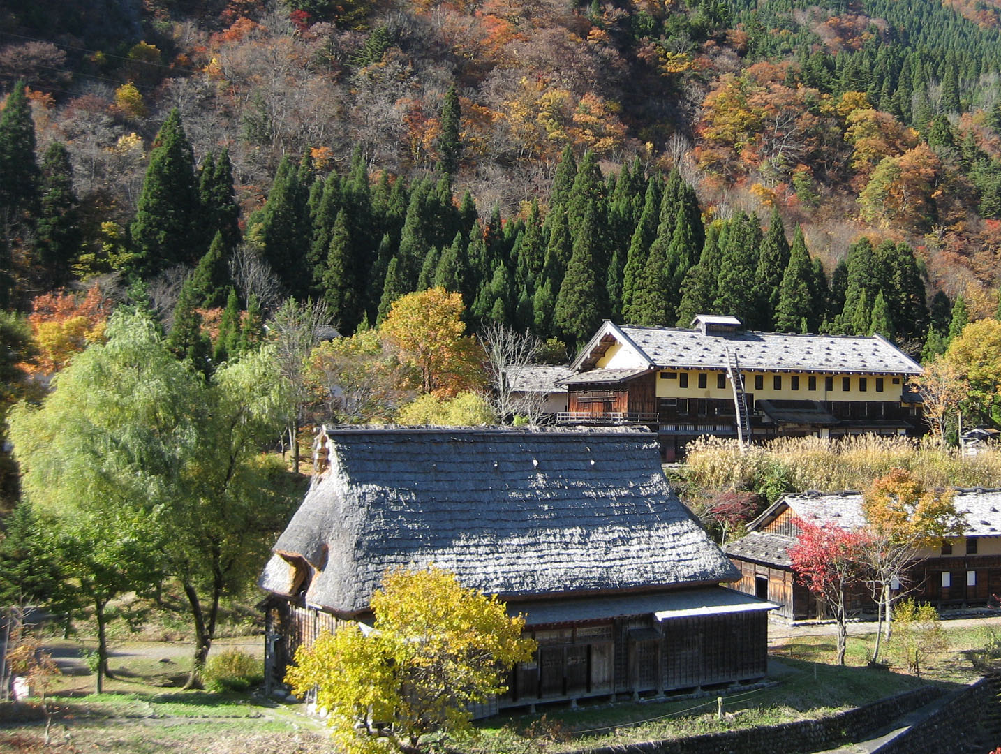
This is a village in the upper reaches of the Tedori River and located in small river terraces between the Tedori River and the Omitsudan River. This area often receives more than four meters of snowfall accumulation and sericulture (silk production) has been the main industry since long ago. This led to a unique architectural style comprising of earthen walls that are able to sustain warm indoor temperatures. Many of these buildings are still visible in the village today.
INFORMATION
Access• Bus:
A bus is available daily from Kanazawa Station.
See here for details: https://en.japantravel.com/ishikawa/how-to-access-shiramine-by-bus/70376
• Car:
Shiramine is accessible by car, with parking available in the center of town, near Shiramine Onsen Soyu.
Address
Shiramine, Hakusan, Ishikawa<MAP>
Free Map for Travelling Around Geoparks
Pocket Geo is a free map service that can be accessed online. It includes information about nearby sites and tourist destinations in the geopark. If you click on the sites, you can see pictures and information about them.
Click here to visit Pocket Geo