AREAS AND SIGHTS

Akudo no Fuchi Pool
akudo no fuchi
![]()
![]()
![]()
![]()
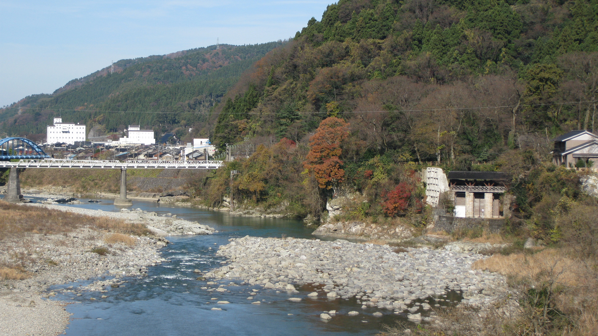
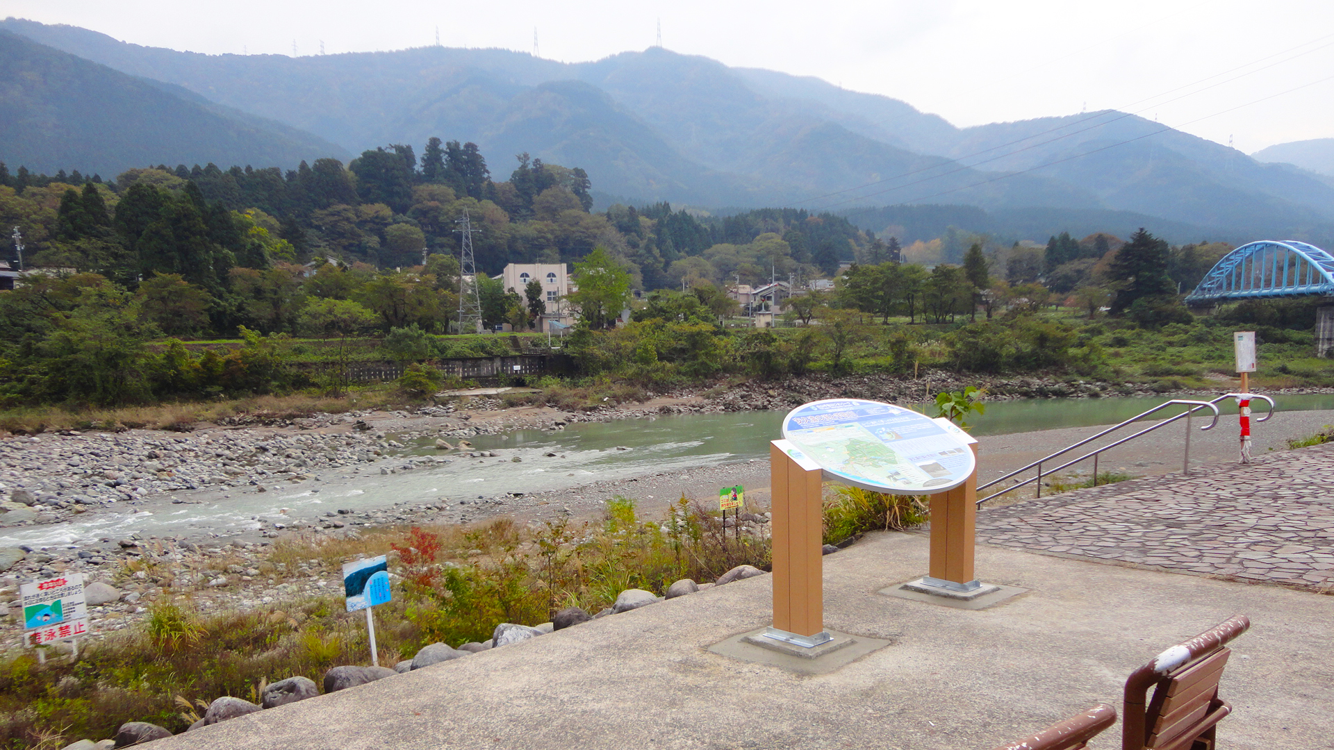
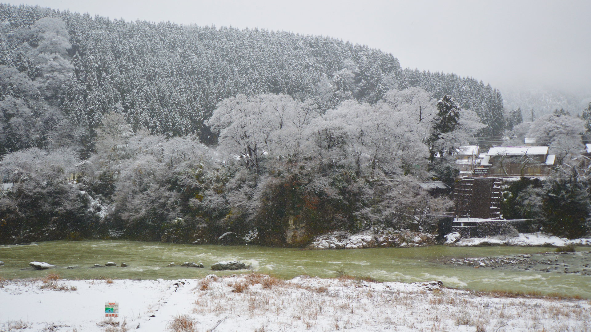
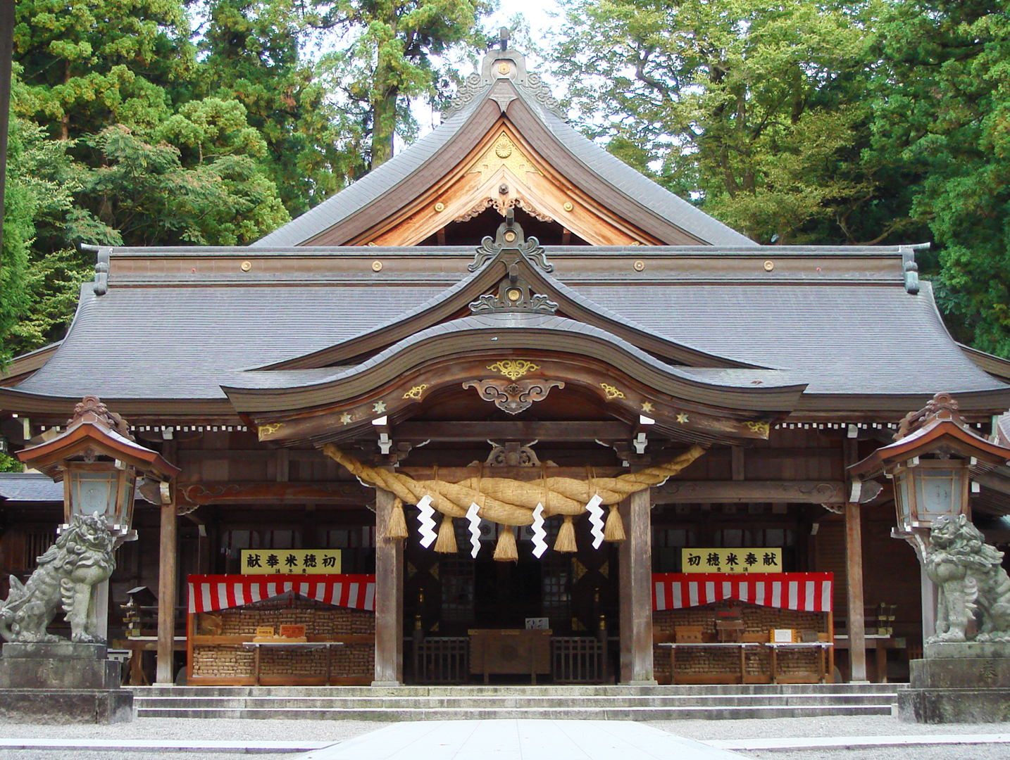
The Akudo no Fuchi, a pool formed by the slowing of the Tedori River, is located in the upper part of the Tedori River Alluvial Fan, near the Shirayama Hime Shrine. The pool can be viewed from the designated lookout on the west side of the river, next to the Shirayama-san Roadside Station. A foot bridge which expanses the river, connecting the Shirayama Hime Shrine to the Shirayama-san Roadside Station, also provides a great spot to see the pool and surrounding river. There is also a lookout from Komiya Park, next to Shirayama Hime Shrine.
It is said that in 717 A.D., a young monk called Taichou (the first priest to climb Mt. Hakusan) was meditating in a nearby cave, when he saw the God of Shirayama riding a white horse upon the Akudo no Fuchi pool. From that event, a temple was built by the pool. However in 1480 during a great fire, the temple was destroyed, leaving behind a Buddha statue which was then carried elsewhere. Beside Komiya Park you can see ancient sake cups, used for rituals at the temple before it was destroyed.
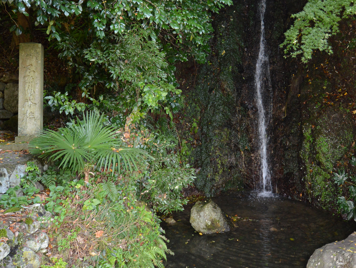
From the end of the Edo Period (mid 1800s) through to the Meiji Era (late 1800s), in order to prevent droughts, village official Gonbei Eda built an irrigation channel by digging through the hard rock wall of the pool to redirect the large reservoir of water. Although Gonbei’s tunnels are no longer used, they laid the foundations for the Shichika Yosui Irrigation Channels which currently irrigate the highly agricultural Tedorigawa Alluvial Fan area. You can see the beginning of the irrigation channels, and a display of their history, at the museum beside Komiya Park.
It is said that in 717 A.D., a young monk called Taichou (the first priest to climb Mt. Hakusan) was meditating in a nearby cave, when he saw the God of Shirayama riding a white horse upon the Akudo no Fuchi pool. From that event, a temple was built by the pool. However in 1480 during a great fire, the temple was destroyed, leaving behind a Buddha statue which was then carried elsewhere. Beside Komiya Park you can see ancient sake cups, used for rituals at the temple before it was destroyed.
From the end of the Edo Period (mid 1800s) through to the Meiji Era (late 1800s), in order to prevent droughts, village official Gonbei Eda built an irrigation channel by digging through the hard rock wall of the pool to redirect the large reservoir of water. Although Gonbei’s tunnels are no longer used, they laid the foundations for the Shichika Yosui Irrigation Channels which currently irrigate the highly agricultural Tedorigawa Alluvial Fan area. You can see the beginning of the irrigation channels, and a display of their history, at the museum beside Komiya Park.
INFORMATION
Access• Public transport:
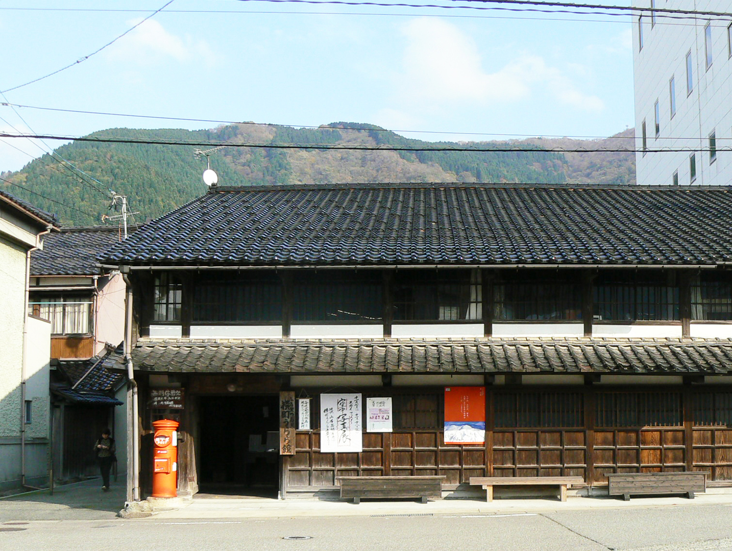
The nearest train station is Tsurugi Station, approx. 2.5km away. Bicycles can be rented from the Hakusan City Tsurugi Branch near the station for easy access. See Townscape of Tsurugi
• Car:
Free parking available at the Shirayama-san Roadside Station.
Address
Wasadanimachi, Nomi, Ishikawa<MAP>
Free Map for Travelling Around Geoparks
Pocket Geo is a free map service that can be accessed online. It includes information about nearby sites and tourist destinations in the geopark. If you click on the sites, you can see pictures and information about them.
Click here to visit Pocket Geo